Salvesen Aeros


City: Salvesen, Stromness District, South Georgia
Population: 38,000
Home Field: True North Park (capacity: 6,000)
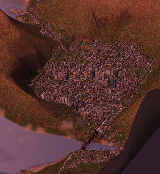 A map of Salvesen. The city's sea port is in the upper-left, while the airport is out of view, but is situated to the left of the image (accessible only by road tunnel).
On South Georgia, a well-known element of the weather is the wind. It blows from west to east quite harshly, leaving SGI's western coast much more exposed to the elements. Most cities lie on South Georgia's calmer eastern coast, shielded by the mountains. However, researchers found one location on the island's west coast where habitation could be managable. Situated inside a crater, the city was founded to give the country a western link for incoming ships and aircraft.
Salvesen was thus born out of necessity. In 1994, the town built the Stromness District Airport: the island's first proper airport. Carved out of a mountainside and susceptible to high winds, the airport is known as one of the toughest in the world to land passenger aircraft, and airlines world-wide with Salvesen as a destination employ only their top talent for the journey. The city's sea port is also a source of much demand, with many products arriving in the country from Asia via sea shipment.
The baseball team was named the Salvesen Aeros, after the world-famous (infamous?) airport. With time, a road and rail link was carved through the center of the island to Grytviken to the east, and hugging the coast line south to the Carse region in Pajt-Vorten and Annenkov. Despite the isolation, the city continues to be a vital link for the country.